Originally posted on ZoomRadar
By now everyone seems to have caught on to the reality that this winter has been anything but winter in the contiguous United States. As of January 30th, only 27.3% of the contiguous United States was covered in snow.

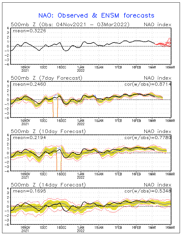
Compare this to last year’s 39.6% and it is easy to see that winter has been easy thus far. This may leave many wondering, where is winter and now that it is nearly February, is it already over? For these answers, we can turn to the North Atlantic Oscillation (NAO), which has remained fairly positive this winter.

When the NAO is positive, it means that the jet stream is farther north than usual over the northern Atlantic area. The direct effect of the jet stream being farther north than usual allows for warmer temperatures to occur across the contiguous United States thus limiting the potential for the air to be cold enough for snow on any given day. As the charts above show, the NAO has been positive most of winter with only a couple very brief exceptions and the forecasts show that this pattern is likely to continue into February.

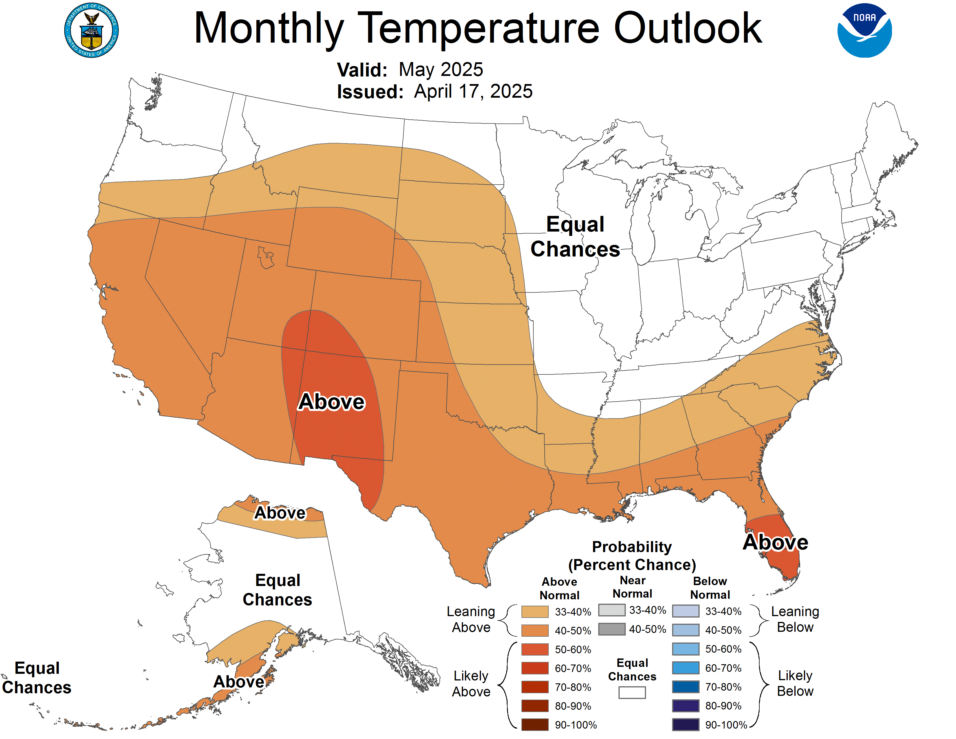
When looking at the current 30 day temperature outlook for the United States, we see these above average temperatures continue to be forecasted, especially across the eastern two-thirds of the country. That being said, it is unlikely that the snowfall debts that have been accumulating this season will be erased. This winter will go into the books as the year without much of a winter for most areas across the contiguous United States.

In the image above, the yellows to the reds depict areas with below average seasonal snowfall through January 30th with the reds being extremely below average. However as the image shows, not all of the United States has been spared this season, some areas depicted in the blues above, have actually received above average snowfall so far this season. Additionally, many areas in Alaska, where winter has been bottled up this year due to that positive NAO, have received near record and record amounts of snow.
So to answer the question of whether winter is over, historically speaking we are just through the hardest days of winter and beginning the upward climb to spring and when considering the NAO forecast, it is likely that winter will continue to spare most of the contiguous United States. But why leave it up to meteorologists to decide, check out what Punxsutawney Phil has to say on Groundhog’s Day and see whether or not we should expect six more weeks of winter or not. Early predictions indicate that Phil will not see his shadow signifying an early start to spring and thus agreeing with what meteorologists are expecting.
